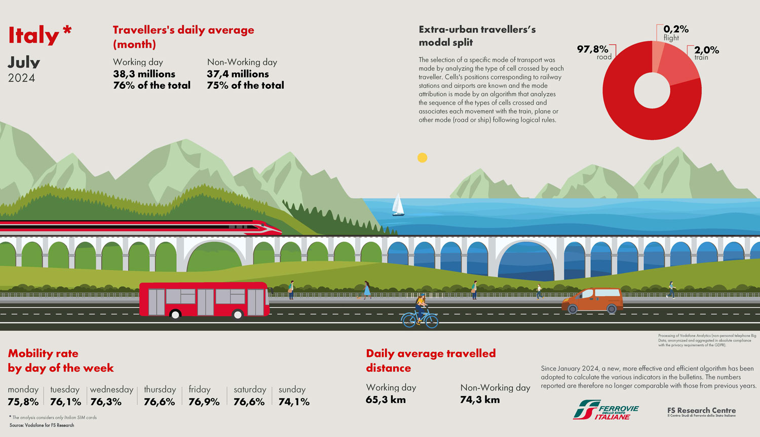
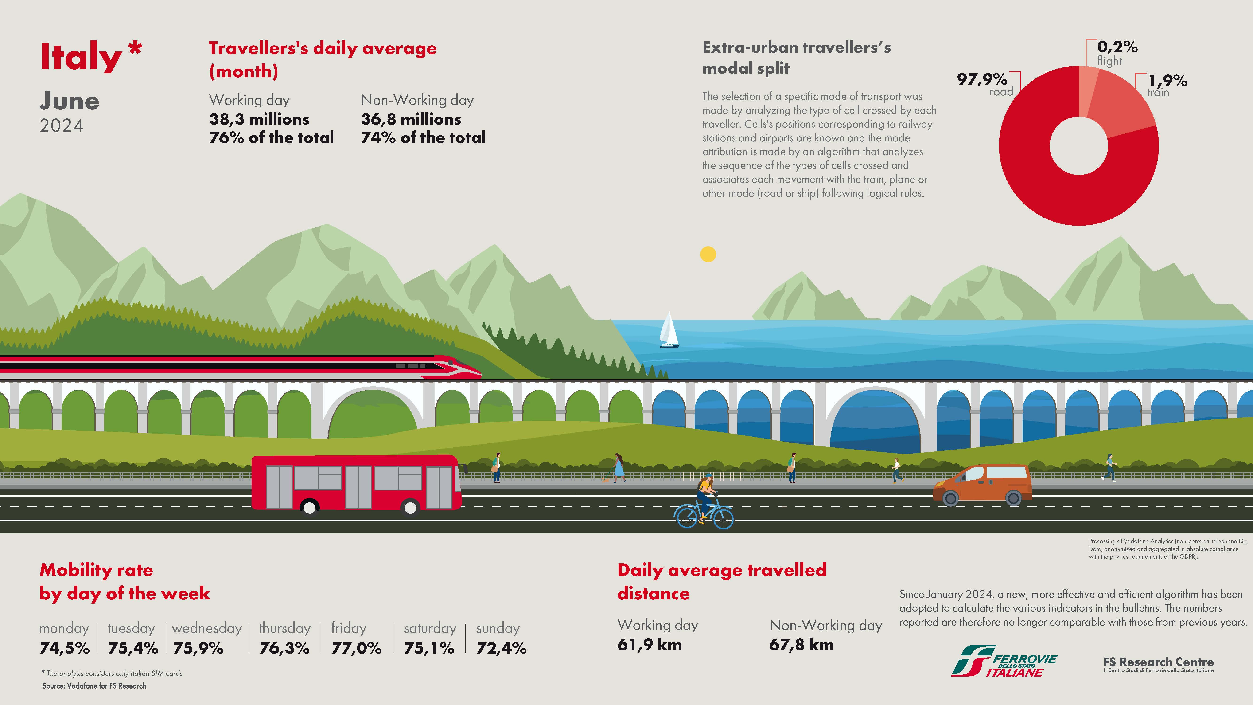
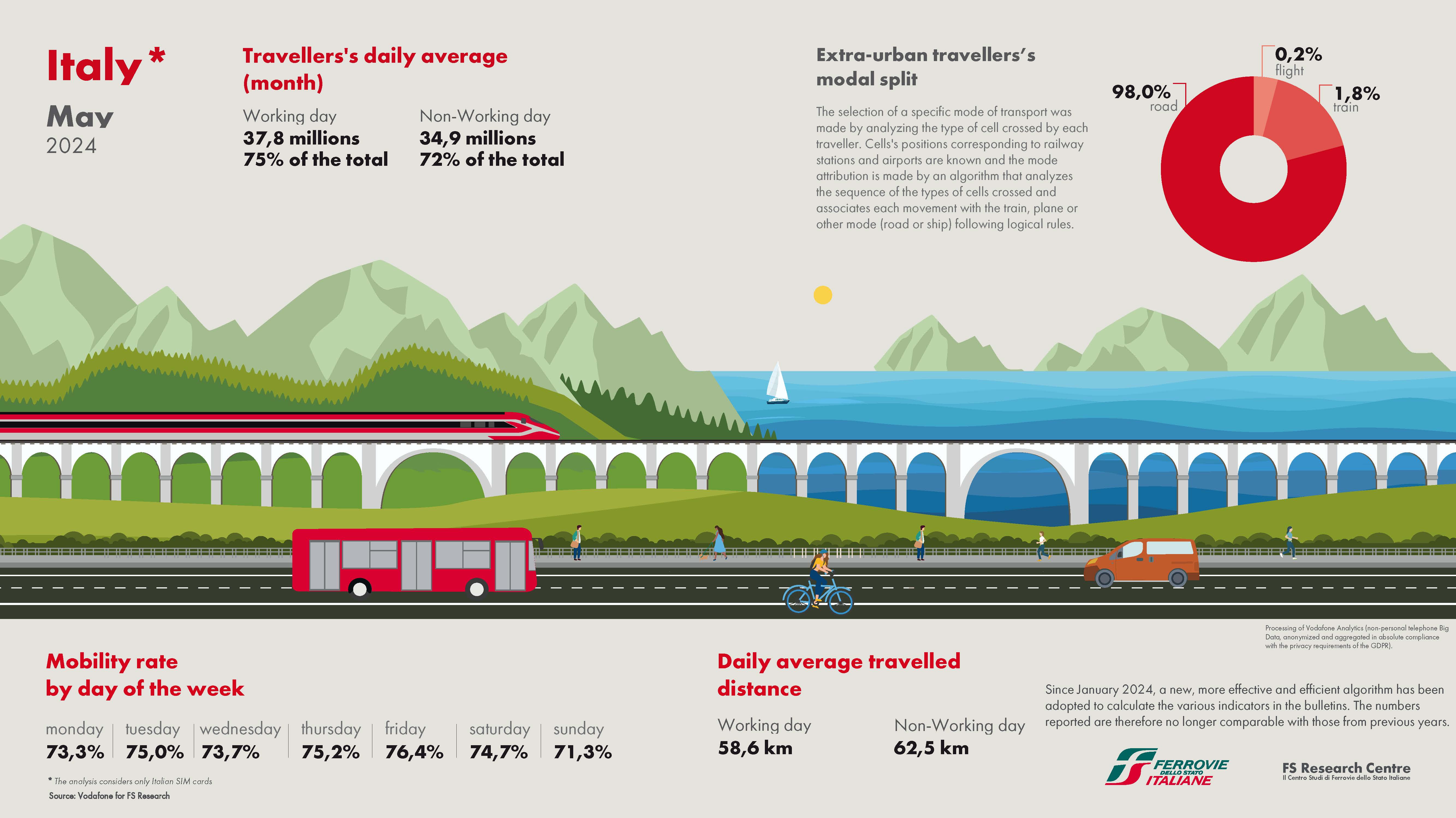
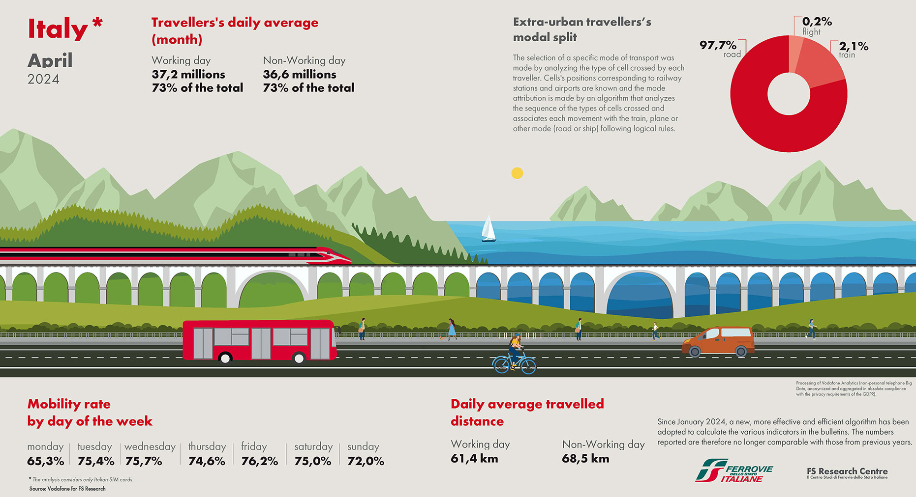
Mobility in Italy

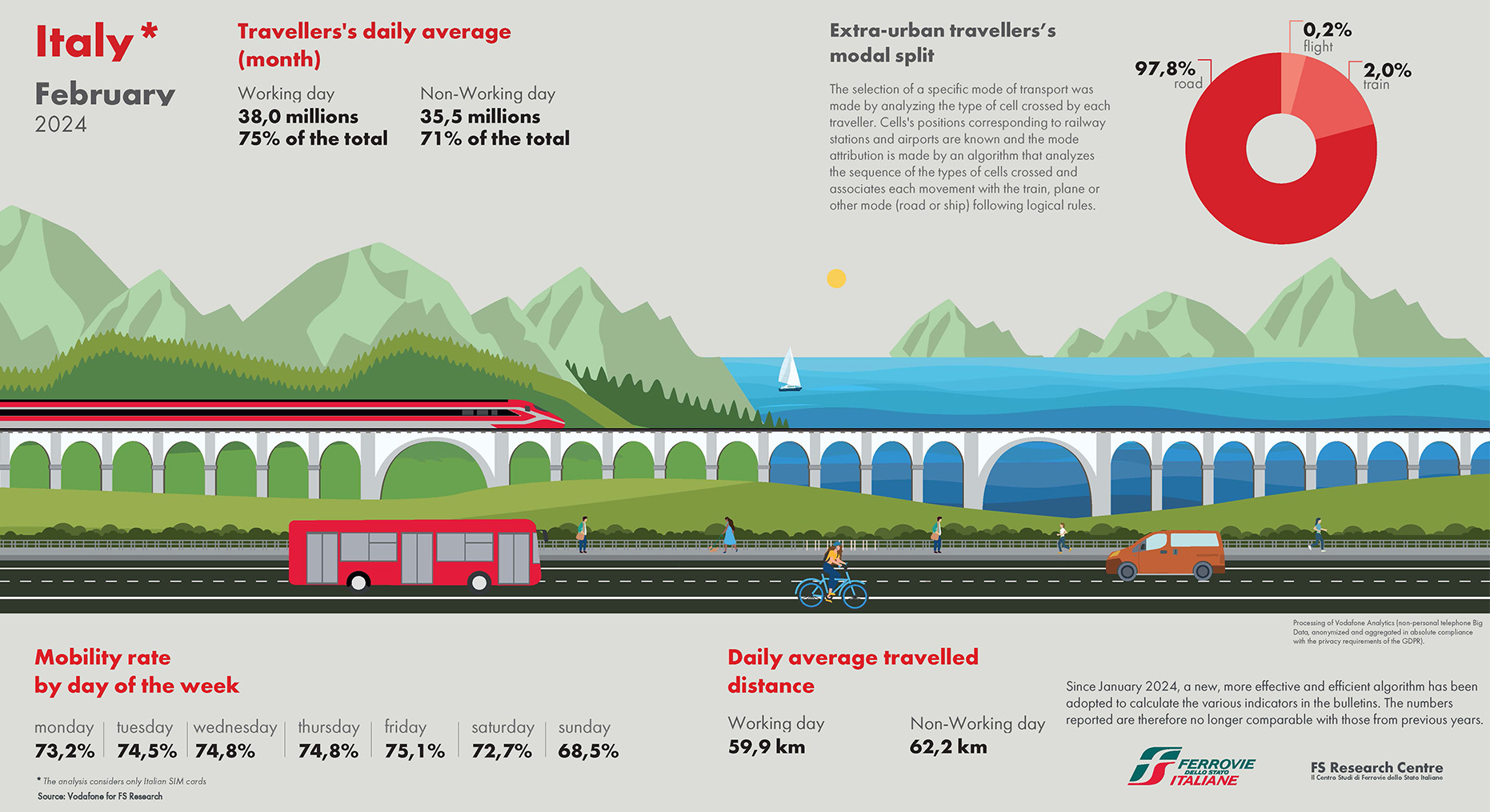
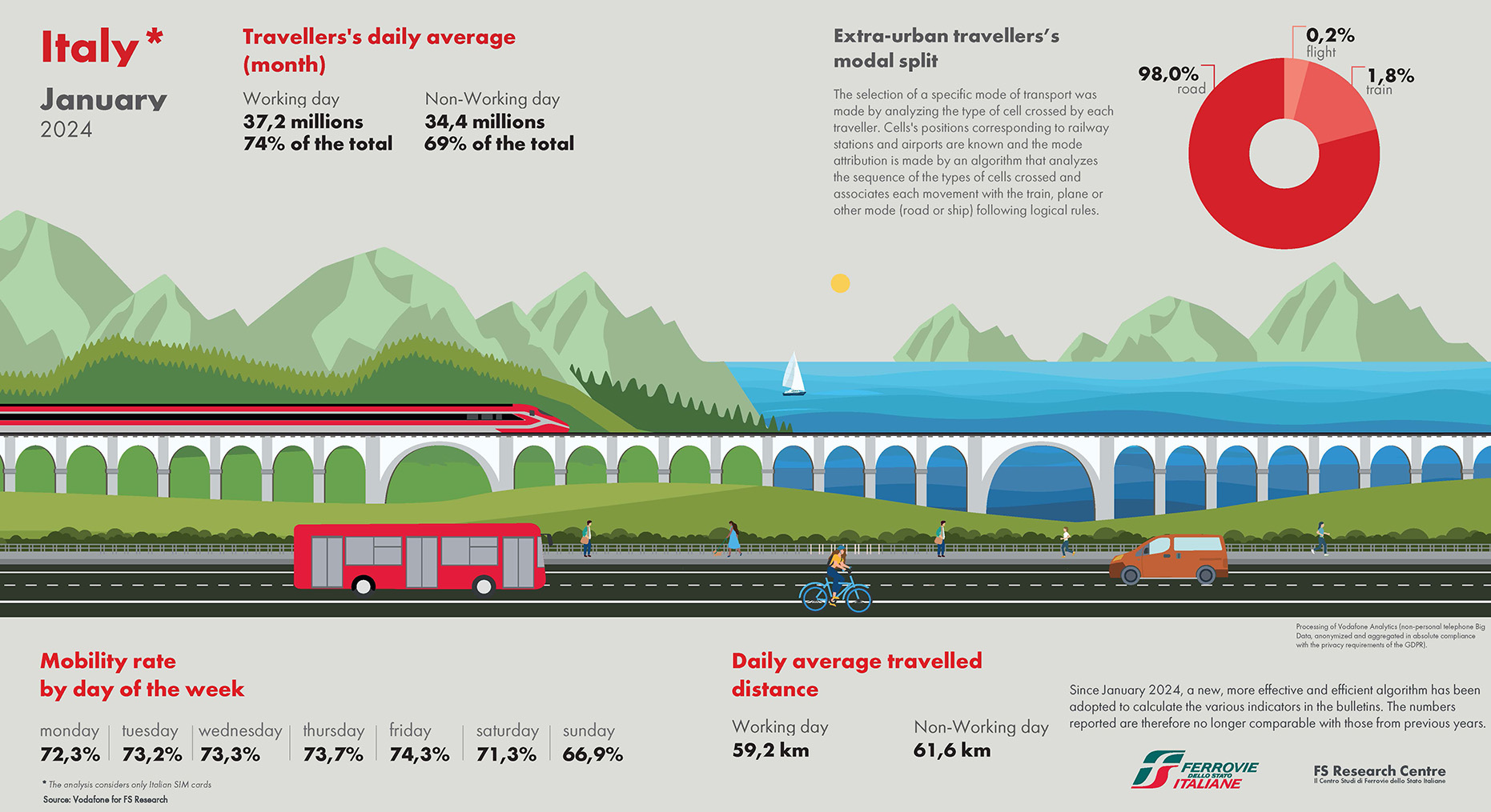
Planning transport systems cannot be separated from an in-depth knowledge of mobility users habits, so that a schematic representation of reality can be developed for forecasting the effects of possible interventions. Today is emerging the need to fill the information gap in current official statistics on people’s movement in various territorial contexts and to answer quickly in the provision of information regarding mobility. New technologies allow the collection and processing of large and complex data sets, Big Data, obtaining more information for mobility modelling. The FS Group has an extensive amount of data at its disposal, through which it process information to produce targeted strategies depending on the type of customer.
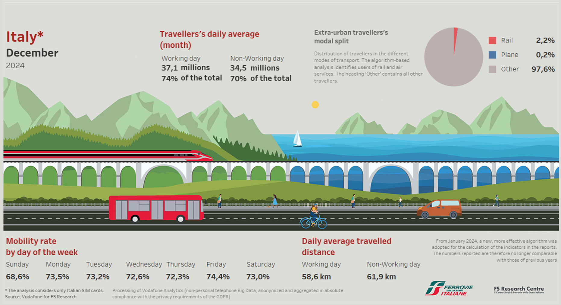
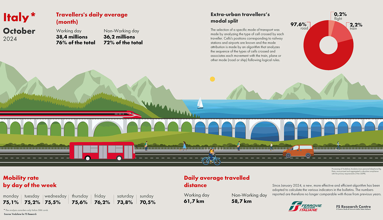
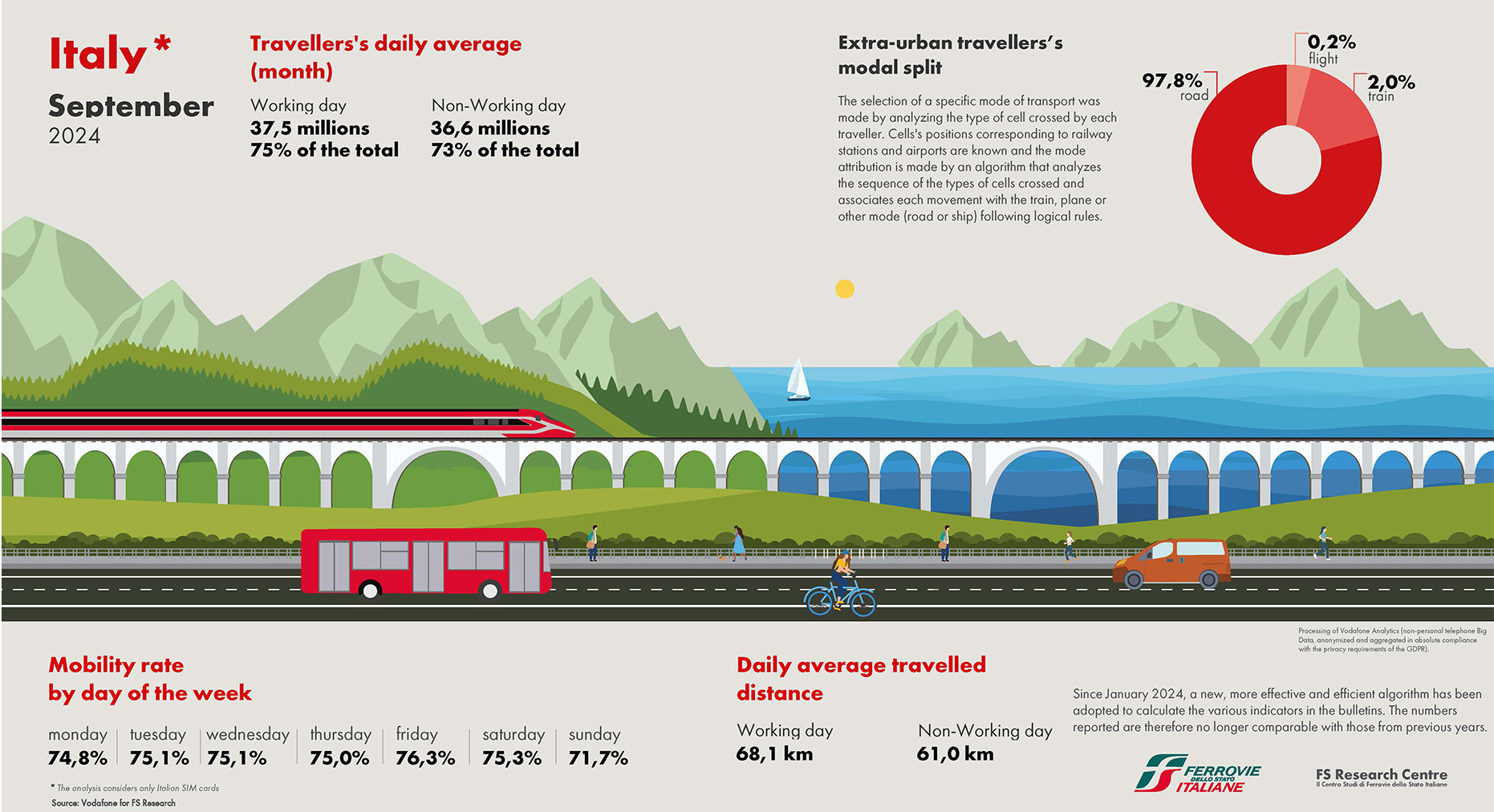
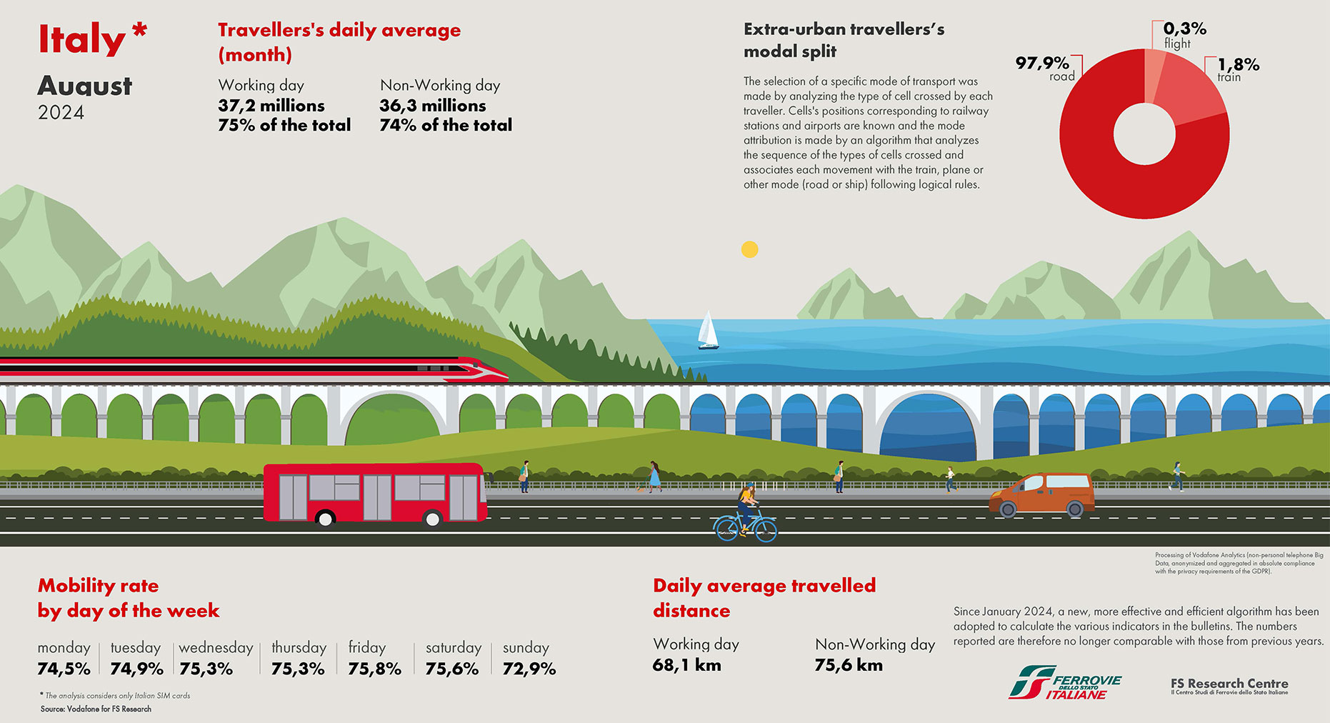
FS Research Centre analyses the status of people’s mobility in Italy through a geospatial data intelligence platform using anonymised telephone Big Data. It is also possible to analyse seasonal variations in mobility behaviour, thanks to being real-time compared to previous month. The analysis refers to mobility within the Italian territory in reference to the population with an Italian SIM card (so, having a mobile phone) that approximately age twelve and over. The mobility analysed relates to total trips, where a “trip” includes all intermediate stops of less than one hour, within a single origin-destination trip. The distance travelled is estimated as the total of distances, including stops. To give an example, the journey “home - stop for make fuel - work” is a single trip. Movements of less than 800 metres were eliminated, considering them as “remaining in one physical location”.
